 BGS Data Catalogue
Marine geophysics
Type of resources
Topics
Keywords
Contact for the resource
Provided by
Years
Formats
Representation types
Update frequencies
Scale
-
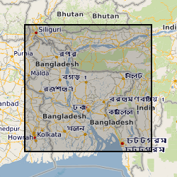
This dataset is an archive of the following original data for the seismic reflection surveys conducted by the BGS in Bangladesh for PetroBangla (Bangladesh state oil & gas company) and the UK Overseas Development Agency (funding body): Observers' logs, Surveyors' reports, Location data tapes, Field data recording tapes, Processed data tapes and various stages of processing: demultiplexed field data to migrated stack (not all available for all profiles). These data are kept as archive copies. They are only available with the agreement of PetroBangla and the ODA. Approx. written records and approx. 1200 tapes.
-
The British Geological Survey hold a collection of data recorded during marine geophysical surveys which includes digital data and analogue records. These data result from approximately 350,000 line kilometres of multi-instrument geophysical survey lines. The data include seismic, sonar, magnetic, gravity, echo sounder, multibeam bathymetry and navigation data. The seismic data are mainly for airgun, sparker, boomer and pinger. The data were primarily collected by BGS and the collection also includes additional third party data. The data are primarily from the UKCS (United Kingdom Continental Shelf). The data are stored within the National Geoscience Data Centre (NGDC) and the Marine Environmental Data and Information Network (MEDIN) Data Archive Centre (DAC) for Geology and Geophysics. The majority of legacy geophysical paper records are available as scanned images viewable via the BGS Offshore GeoIndex www.bgs.ac.uk/GeoIndex/offshore.htm. Other records can be scanned on request. Older records are of variable quality. Data not yet available online including segy are available on request enquiries@bgs.ac.uk. The data are applicable to a wide range of uses including environmental, geotechnical, geophysical and geological studies. Reference: Fannin, NGT. (1989) Offshore Investigations 1966-87. British Geological Survey Technical Report WB/89/2, British Geological Survey.
-
The Marine Reports Archive held by BGS includes published and unpublished reports created by BGS and acquired from various sources. The reports which date from the 1960s onwards include the BGS Marine Reports Series, Marine Commercial reports and associated records, Palaeontology reports and other specialist reports. Examples of report types are data acquisition and processing reports, site investigation reports and interpretation reports. The reports are primarily for the UKCS (United Kingdom Continental Shelf). The coverage of some reports is the entire UKCS whilst other have only regional or very localised extent. The reports are applicable to a wide range of uses including environmental, geotechnical, geophysical and geological studies.
-
This dataset comprises data from Wessex Archaeology surveys which were conducted over various wreck sites between 2003 and 2010. Three of these datasets were acquired in English waters, one in Welsh waters and one in Scottish waters. The geology and geophysics component of the data are archived by British Geological Survey (BGS) in the Marine Environmental data and Information Network (MEDIN) Data Archive Centre (DAC) for Geology and Geophysics. The data include multibeam echosounder, single-beam echosounder, sidescan sonar, sub-bottom profiler, magnetometer, and geological data (vibrocore logs and photos). Data were also provided to other archive centres as appropriate - UKHO (bathymetry), Royal Commission Ancient and Historic Monuments Wales (geophysics), Royal Commission on the Ancient and Historical Monuments of Scotland (geophysics and diving/ROV), Archaeology Data Service (diving/ROV). Although generated for archaeological purposes, these high quality and resolution data are capable of re-use by marine surveyors and scientists from a range of different fields. Data are delivered via the BGS Offshore GeoIndex www.bgs.ac.uk/GeoIndex/offshore.htm and additional data are available on request enquiries@bgs.ac.uk.
-
The Marine Maps and Chart Archive held by BGS contains maps created by BGS (the majority of which result from BGS offshore mapping projects) and also maps acquired from various other sources (e.g. UK Hydrographic Office and MCA Civil Hydrography Programme survey charts). The maps which date from the 1960s onwards are very variable in subject type and scale ranging from survey navigation to geological interpretation. The maps are primarily for the UKCS (United Kingdom Continental Shelf). The coverage of some map types is the entire UKCS whilst other have only regional or localised extent. The maps which are a mix of paper and digital are applicable to a wide range of uses including environmental, geotechnical, geophysical and geological studies. range of uses including environmental, geotechnical, geophysical and geological studies. Scanned maps can be viewed via the BGS maps portal http://www.bgs.ac.uk/data/maps.
-

The 3D multi channel seismic data were acquired as part of a collaborative investigation into models of magmatic segmentation between the Scripps Institute of Oceanography and BIRPS (the British Institutions Reflection Profiling Syndicate). The 3D EPR (East Pacific Rise) ARAD (Anatomy of a Ridge Axis Discontinuity) EW9707 cruise was undertaken in September and October 1997 to provide both refelction and wide-angle seismic data for the study of the overlapping spreading centre (OSC) at 9 degrees 3 minutes N on the East Pacific Rise. The data were acquired with a single source and a single streamer with a nominal line spacing of 100 m. The 3D-EPR ARAD survey was a joint NERC/NSF (US National Science Foundation) funded project and the copyright for this survey is held jointly. Reference: Bazin, S. Harding, AJ. et al. (2001) Three-dimensional shallow crustal emplacement at the 9 degree 03 minute N overlapping spreading center on the East Pacific Rise, Journal of Geophysical Research.
-
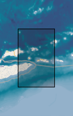
In 1992, BIRPS joined with the Indonesian Marine Geological Institute to record two long multichannel normal-incidence reflection profiles, one of which is DAMAR, the other TIMOR, and one short profile (API) close to the volcano Gunung Api. The survey provides a modern analogue to tectonics hypothesized to have occurred across the Iapetus suture zone of northern England 450-400 Ma. The Banda Arc of Indonesia near the island of Timor is widely recognized as the premier example of the active subduction of continental crust and lithosphere beneath oceanic lithosphere. The crossing of a modern island arc and close passage to active volcanoes was intended to image reflections associated with magma in the crust and uppermost mantle.
-
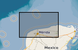
BIRPS (the British Institutions Reflection Profiling Syndicate) acquired almost 650 km of offshore seismic data and 300 km of onshore seismic data over the Chicxulub impact crater. The data were recorded to 18 s two-way time.
-

MONA LISA (Marine and Onshore North Sea Acquisition for Lithospheric Seismic Analysis) seismic data was acquired by BIRPS (the British Institutions Reflection Profiling Syndicate) across the Ringkobing-Fyn High of the central North Sea were designed to study the crust near a hypothesized Caledonian age triple junction associated with the colliding continental crust of Laurentia, Avalonia (Gondwanaland) and Baltica. The specific target was the eastward continuation of the Caledonian Front (Iapetus Suture), as previously recognised on NEC (North East Coast line), MOBIL (Measurements over Basins to Image Lithosphere), NSDP (North Sea Deep Profile) and BABEL (Baltic and Bothnian Echoes from the Lithosphere) profiles, in northern Europe. 1112 km of data were acquired, recorded to 26 s two-way time.
-

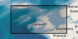
Faeroe-Iceland Ridge Experiment (FIRE) was acquired by BIRPS (the British Institutions Reflection Profiling Syndicate). The primary target was anomalously thick oceanic crust along the Faeroe-Iceland Ridge that was possibly formed by underplating due to the proximity of the Iceland hotspot. FIRE made use of 110 land seismometers to record the airgun shots. The resulting velocity models and reflector geometries have proved critical in interpretation of variations in crustal volumes along the ridge. The data were recorded to 23 s two-way time.